Measure, which provides UAS services for enterprise customers, has announced its new division called Measure Media (M2), which will be used to service the arts and entertainment industry.
M2 operates the first nationwide network of full-time UAS pilots that specialize in fulfilling the airborne storytelling needs of small screen and big screen projects alike.
During its first two months, M2 operated in stealth mode, but it has already worked with a wide range of customers, including pop star Rihanna, and television networks ABC and CBS.
Air
Air
ProSky Studio achieves ARGUS Unmanned Gold Rating
ProSky Studio, which is a full-service aerial UAS provider, has achieved ARGUS International's ARGUS Unmanned Gold Rating, which is one of three achievable ARGUS Ratings for unmanned operators.
In order to earn the ARGUS Unmanned Gold Rating, unmanned operators must meet several criteria, including having at least one UAS in operation, they must have pilot backgrounds checked, and they must be a legal entity with applicable insurance.
“More than ever, creating a culture of safety is paramount within the rapidly expanding Unmanned Aerial Systems industry,” says Joe Moeggenberg, ARGUS CEO and Founder.

CNN granted Part 107 waiver to fly small UAS over people
The FAA has granted CNN a “first-of-its-kind Part 107 waiver” that allows the media organization to fly a small UAS over people.
Considered an industry milestone, this waiver, for the first time, permits real-world UAS operations over people, giving CNN the ability to fly its 1.37-pound Snap UAS in a variety of environments, up to an altitude of 150 feet above ground level (AGL).
“We are delighted that the FAA has granted CNN a waiver that has a meaningful and practical application to our newsgathering operations,” says Greg Agvent, Senior Director of National Newsgathering Technology and CNN AIR.

UAS used to map damage done to Holiday Beach, Texas by Hurricane Harvey
In the aftermath of Hurricane Harvey, Texas A&M University-Corpus Christi—commonly known as the Island University—used UAS to map Holiday Beach, Texas.
The map, also known as an “ultra-high resolution ortho-mosaic image,” was created using the data collected by the UAS, and it is available on the school's website.
“Disaster sites are not easily accessible due to debris and other obstacles, so we’re hoping that collecting ultra-high-resolution aerial maps from UAS can significantly help,” says Dr. Jinha Jung of the Island University's Department of Engineering and Computing Sciences.
Washington State Patrol using UAS to fly over crash scenes
The Washington State Patrol (WSP) is crediting its UAS with helping to ease backups that are caused by crashes on the road.
Since the start of WSP’s pilot program back in July, UAS have been used to fly over 20 crash scenes.
According to Washington State Patrol Detective Eric Gunderson, one of the UAS named ‘Ice Man’ recently flew over a rollover crash that was blocking two lanes of traffic on Interstate-5 in Tacoma, Washington.
Gunderson says that using the UAS, he was able to capture more than 200 digital photos, which allowed him to document the scene in just over 20 minutes. It would have taken three to four hours to document the scene without the UAS, according to Gunderson.

Inside the October 2017 issue of Unmanned Systems
The October 2017 issue of Unmanned Systems looks at the market for UAS sensors and the factors driving new growth; the U.S. Navy’s plan to get a new maritime ‘truck’ for its mine countermeasure work; and a new U.K. testing range for unmanned systems. That and much more including our popular Viewfinder aerial photo gallery and a breakdown of the types of waivers to Part 107 being granted by the Federal Aviation Administration.

DJI launches new Local Data Mode to stem privacy concerns
Drone maker DJI, the leader in the consumer UAS field, today launched a new Local Data Mode that allows users to fly without internet data transfer.
The move comes after the U.S. Army ordered its members to stop using off-the-shelf systems from China-based DJI, saying its drones could retain and transmit sensitive data, including the time and location of drone flights.
The new privacy mode stops internet traffic to and from the DJI Pilot app, using instead Local Data Mode, which doesn’t send or receive any data over the internet.
Autonomous Air Taxi completes first test flight in Dubai
The Autonomous Air Taxi (AAT), which is expected to be used for the world’s first self-flying taxi service, recently completed its maiden concept test flight at a location near a park in Dubai.
The vehicle has been supplied by a Germany-based specialist manufacturer of autonomous air vehicles called Volocopter.
“After the remarkable success of the first driverless metro in the region, we are glad to witness today the test flight of the Autonomous Air Taxi,” says HH Sheikh Hamdan bin Mohammed bin Rashid Al Maktoum, Crown Prince of Dubai.
, photo courtesy of the Government of Dubai.")
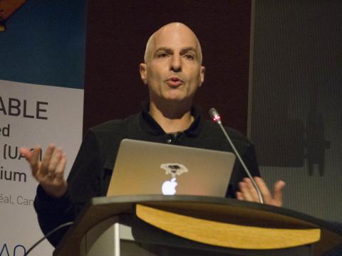
From Xponential to UTM framework: ICAO seeks harmonized approach
Continuing a process that kicked off at AUVSI’s Xponential conference in Dallas earlier this year, the International Civil Aviation Organization is seeking to develop a global concept of operations for an unmanned aircraft traffic management system.
ICAO’s remotely piloted aircraft program manager, Leslie Cary, issued a request for information for UTM systems at Xponential, and ended up receiving 76 proposals from industry, academia and others.
That led to the Drone Enable conference, held Sept. 22-23 in Montreal, at ICAO’s headquarters, where the developers of many of those proposals gathered to discuss what a global UTM framework should include.