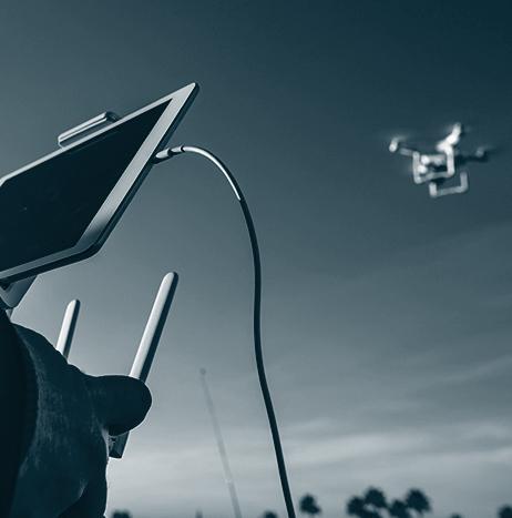
UTM
UTM
Phase II - AUVSI USDPS Virtual Conference Next Week
Media Contact: Jackie Beckwith, jbeckwith@auvsi.org
AUVSI Welcomes Remote ID and Operations Over People Final Rules for UAS
Today, the Federal Aviation Administration (FAA) has delivered a Final Rule on Remote Identification (ID) for unmanned aerial systems (UAS). Thought of as a digital license plate for drones, the objective of Remote ID is to ensure that a UAS in flight is providing identification and location information that authorities can access. The FAA also released the final rule for Operations Over People, which includes rules for operations at night.
Drone Harmony decides to embed its flight mapping solutions with Altitude Angel's market-leading data
Unmanned Traffic Management (UTM) technology provider Altitude Angel has announced that software company Drone Harmony has opted to equip its flight mapping solutions with Altitude Angel’s market-leading data.
Drone Harmony is developing a data capture platform that enables enterprises to capture quality data of infrastructure assets. According to Altitude Angel, this addresses the main hurdle encountered when attempting to tap into digitalization benefits: the lack of complete, quality, and up-to-date digital databases representing the enterprise assets.

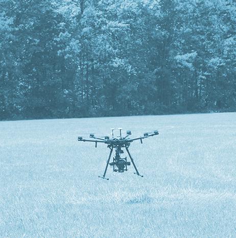
uAvionix participates in deployment of North Dakota's statewide BVLOS network
uAvionix has announced its participation in the deployment of North Dakota’s statewide Beyond Visual Line of Sight (BVLOS) UAS infrastructure and network, Vantis, which is led by the Northern Plains UAS Test Site.
uAvionix is a strategic partner to Thales’ TopSky Unmanned Traffic Management (UTM) platform, so it is deploying terrestrial command and control (C2) infrastructure and a cloud-based C2 service, which enables centralized management, coordination, and C2 handoffs. In turn, this will enable BVLOS missions across the key-site deployment area of McKenzie County, North Dakota.
 UAS infrastructure and network led by the Northern Plains UAS Test Site. Photo: uAvionix")
Thales completes important work to enable BVLOS ops in North Dakota
Thales has announced that it has successfully completed the preliminary design review for the key site implementation of Vantis, the statewide UAS network for BVLOS operations in western North Dakota.
As part of the BVLOS network, Thales will deploy surveillance and communications infrastructure in the greater McKenzie County area. The sensors and communications network will support mission and network operations.
“North Dakota’s Statewide UAS Network, known as Vantis, is truly the first of its kind,” says Jean Ferré, Vice President of Airspace Mobility Solutions, Thales.
Purdue University's UAS Program purchases Simlat’s UTM simulation
Simlat has announced that Purdue University’s UAS Program recently purchased and deployed Simlat’s simulation for UAS Traffic Management (UTM), POLARIS, along with Simlat’s C-Star UAS Simulator.
“We are excited to partner with Simlat and incorporate this innovative technology into our UAS program,” says Dr. Damon Lercel.
According to Simlat, POLARIS provides simulated UAS traffic at scale, simulating the behavior of “rogue” or malfunctioning UAS, while also generating the clutter made by thousands of automated flights.

Developing a positive public perception of UAS is a collaborative effort between stakeholders
The UAS industry has an excellent safety record, but the occasional bad actor can still dominate media coverage, which can have an immeasurably negative impact on the industry's public perception.
“The coverage of bad incidents is so much heavier than the coverage of the everyday useful commercial flights that are happening safely,” says Miriam McNabb, CEO & contributing editor, JobForDrones & DRONELIFE, during a session titled “Public Perception of Unmanned Systems – How to Positively Shape Public Perception by Educating the Media, and Working Together as an Industry.”
AirMap awarded contract to provide UTM service to USAF's Agility Prime program
AirMap has been awarded a contract to provide UAS traffic management (UTM) services to the United States Air Force’s (USAF) Agility Prime program.
In preparation for scaling of advanced air mobility operations, the USAF will use AirMap’s UTM platform to support testing of electric vertical takeoff and landing (eVTOL) aircraft.
“AirMap is proud to partner with the USAF to provide industry-leading UTM services for advanced air mobility operations,” says Larry Berkin, GM of the AirMap Defense Group, an AirMap business unit focused on providing mission-critical technologies to the US Department of Defense.

PrecisionHawk awarded two patents for its UTM technologies
PrecisionHawk has been awarded two patents for technologies it has developed for UAS traffic management (UTM).
Known as the ‘Automated Unmanned Air Traffic Control System,’ the patents are designed to enable collision avoidance between drones and manned aircraft, which is achieved by transmitting real-time flight data from drones to a UTM server prior to and while in-flight.
