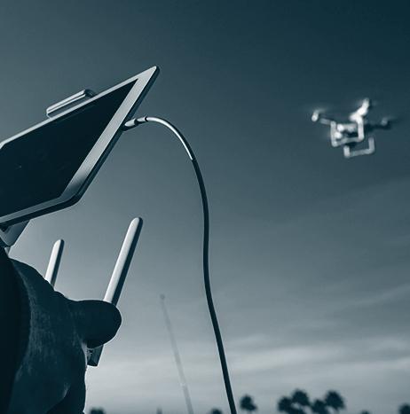
The proliferation of micro, mini and small unmanned aircraft systems is nothing new in the defense community.
However, as the capabilities of so-called “near peer” adversaries continue to advance at a rapid pace, the special operations community in particular is considering next-generation technology, tactics, techniques and procedures to maintain tactical overmatch on the battlefield — including taking some tips and tech from drone racers.
Speaking to Unmanned Systems, defense sources associated with the NATO Special Operations Forces community describe multiple development efforts in this area, designed to increase capacity and skill sets in response to emerging requirements across the current operating environment.
UAS
UAS

SenseFly's software integration with Trimble optimizes UAS mapping workflow for geospatial professionals
SenseFly has announced a new software integration with Trimble that optimizes the UAS mapping workflow for geospatial professionals, ultimately ensuring the smoothest possible end-to-end mapping UAS workflow.
Within their drone's recently launched eMotion 3.5 software, senseFly operators can now transform a senseFly S.O.D.A. camera’s georeferenced imagery into an “automatically-collated project (in .jxl format).”
This allows for the simple, one-click import of UAS imagery into the Trimble Business Center Aerial Photogrammetry module, without having to manually create a project and organize images.
DroneUp enables LAANC available on its operating platform
DroneUp, which is a community-endorsed pilot network and leader in small UAS safe operations and training, has announced that it has enabled Low Altitude Authorization & Notification Capability (LAANC) available on its operating platform, through AirMap LAANC Deep Linking.
DroneUp says that since late 2017, it has been working to offer LAANC and other essential compliance and regulatory features to its pilots.
“We are committed to continuous education and safe operations, and we are excited to add LAANC so our community will have more opportunities to build drone businesses and fly missions,” says Tom Walker, CEO of DroneUp.

PACI receives Part 107 waiver to operate UAS BVLOS
Praxis Aerospace Concepts International (PACI) has announced that it has received a Part 107 waiver from the FAA to operate UAS beyond visual line of sight (BVLOS).
According to PACI, which is based in Southern Nevada, it is now one of the few companies in the United States allowed to offer BVLOS operations for professional aerial work.
“We are absolutely thrilled to be the first Nevada company to receive permission to fly commercial BVLOS,” says Jonathan Daniels, CEO of PACI.
“This is a major step over the hurdle for the commercial UAS industry. This will open up many opportunities for businesses already anchored here and those corporations who want to start-up here at our Searchlight Airpark facility.”
Missouri man rescued with aid of UAS
On the night of March 27, a UAS was used to help rescue a man who drove on to a bridge and found himself in the flooded James River at the Crighton Access Point in Missouri.
The Logan Rogersville Fire Department called on Pilot Tom Baird to provide aerial assistance for this mission. Within seven minutes, Baird got the UAS into the air, and helped crews find the man who needed help faster than if they were to search waterways by boat or on foot.
Weekend Roundup
This Week in the Unmanned Systems and Robotics World
UAVOS has introduced its new Borey-10 fixed-wing UAS. Among its many capabilities and features, the UAS has a heated battery compartment that allows it to fly in temperatures as low as -22F, and it can fly for four hours, nonstop, with a payload of two pounds. The UAS is also equipped with an EW countermeasure system, which makes it possible to conduct research operations in the absence of GNSS signals. (UAVOS)

Hubsan launches 'high-quality, affordable' H501A+ UAS
A UAS company called Hubsan has launched its newest signature product, the H501A+ UAS.
Available starting at $199, the UAS is a “high-quality, affordable drone option,” according to Hubsan.
The H501A+ UAS has a variety of unique features. Among them, the UAS has both a high-quality video camera and photo features, it has a flight time of 20 minutes, and it has GPS positioning, automatic take-off and Return to Home features.
“We designed Hubsan's drones, and the H501A+ model, with quality and affordability in mind,” says Kevin Chen, Hubsan's U.S. branch manager.

SkyWatch.AI partners with Starr Companies to offer 'ingenious telematics-based UAV insurance platform'
SkyWatch.AI, which is a data analysis, risk-assessment and active risk-reduction platform for the UAS industry, has signed an exclusive partnership deal with Starr Companies (Starr) to offer an “ingenious telematics-based UAV insurance platform.”
Through the partnership, Starr will expand its existing UAS insurance product, and offer a unique telematics-based insurance to UAS operators.
DJI integrating FLIR thermal imaging sensor technology into new DJI Zenmuse XT2 drone camera
DJI will integrate a FLIR thermal imaging sensor technology into its new DJI Zenmuse XT2 drone camera, which is DJI’s first dual-sensor and most advanced gimbal-stabilized camera for commercial UAS applications.
The DJI Zenmuse XT2 is built with industrial and public safety applications in mind, and according to FLIR and DJI, the camera expands upon the benefits offered by the DJI Zenmuse XT, which is the first thermal-equipped camera jointly developed by the companies.

From Unmanned Systems Magazine: How can insurers benefit from using drones?
Insurers fundamentally sell and must deliver on promises. So, we expect them to be rock-solid, reliable, and conservative. And yet we also hope that they will innovate, adopt new technologies and adapt accordingly. Each carrier strikes their own balance, which is reflected in their varied approaches to unmanned aircraft.
