The Kansas Department of Transportation (KDOT) is partnering with AirMap, Inc. to deploy the first statewide Unmanned Traffic Management (UTM) initiative in the United States.
Kansas will implement an “airport notification and awareness system for drones,” using AirMap’s UTM technology, providing airports across the state with access to the airspace management system.
Airports that participate in the initiative will be able to accept digital flight notices, communicate with UAS operators, and prepare for UTM milestones that are coming down the pipeline, such as authorization for commercial UAS flights and automating airspace notification.
For Lieutenant Governor Jeff Colyer, this initiative shows how committed the state of Kansas is to the UAS industry.
UAS
UAS
Virginia’s Danville Life Saving Crew to use UAS for search and rescue missions
The Danville Life Saving Crew (DLSC) in Danville, Virginia will begin using small UAS to help them during search and rescue missions.
Through Piedmont Virginia Community College, five members of the DLSC spent 40 hours in UAS ground school, where they learned about FAA regulations, flight operations, human factors and radio communications, which prepared them for their FAA Remote Pilot Certificate exam.
Students participated in the field section of the UAS flight training on July 28. The five DLSC members, alongside Pittsylvania County Sheriff Mike Taylor and five members of the Pittsylvania Sheriff’s Office, demonstrated their flight skills at Dan Daniel Memorial Park.

RPM Aerial Services uses UAS to place GPS tracker on iceberg
In an effort to find a way to safely place a tracker on an iceberg without getting too close to what can often be “unpredictable masses of floating ice,” Holyrood, Newfoundland and Labrador-based RPM Aerial Services, along with a GPS manufacturer in Nova Scotia, recently used a UAS to place a GPS tracker on an iceberg.
The iceberg was about two kilometers outside Petty Harbour, which is another town in Newfoundland and Labrador, Canada.
According to Brian Lundrigan, who started RPM Aerial Services, which is a remotely piloted aerial service company, this pilot project was far from easy.
“It was fairly challenging,” Lundrigan says via CBC News.

DNV GL conducts first offshore UAS survey
DNV GL surveyors have conducted the classification society’s first offshore UAS survey.
The survey was conducted in the North Sea, on the semisubmersible vessel Safe Scandinavia, which supports Statoil’s drilling operations off the coast of Norway.
As a part of the intermediate survey, DNV GL’s UAS pilots checked Safe Scandinavia’s fairleads and their connection with the vessel’s two columns.
“This was a great opportunity for us to demonstrate our drones’ abilities to check the condition of remote external components in challenging offshore conditions,” says Cezary Galinski, Project Manager Classification Poland at DNV GL.

Overwatch Imaging upgrades autonomous image processing capabilities of airborne multi-camera payloads
In collaboration with SOAR Oregon, Hood River, Oregon-based Overwatch Imaging, which specializes in customized large-scale aerial imagery intelligence systems, has successfully completed a year-long program to upgrade the TK-X family of airborne multi-camera payloads’ autonomous image processing capabilities.
The TK-X family of Overwatch payloads include multiple cameras in “an actively stabilized, nadir-oriented mount with automated step-stare camera pointing controls,” which allows for the quick collection of high-resolution multi-spectral imagery.
Also included in the payloads are “embedded GPU-based onboard image processing, with customized software performing real-time multi-image registration, image-based object detection, and image mapping.”

Measure acquires Pilatus Unmanned
Measure, which is a U.S. provider of UAS technologies for enterprise customers, has announced that it has acquired Pilatus Unmanned, a company that specialized in UAS customization for commercial customers, and was one of the first Enterprise value-added resellers for DJI.
The acquisition of Pilatus Unmanned is another indication of the rapid growth taking place at Measure, which recently introduced new technologies and toolkits for the solar and broadcast news industries.
Weekend Roundup
This Week in the Unmanned Systems and Robotics World
LORD Corporation, which develops wireless and embedded sensing systems, has introduced its LXRS+ wireless networking protocol, which features a bandwidth of 16,000 samples per second per channel, and an aggregate system bandwidth of 256,000 samples per second over 16 channels. According to LORD, “the wireless sensor nodes that operate using LXRS+ protocol are designed to operate at incredibly low-power,” which allows battery powered networks to operate for long periods of time, and “makes the use of energy harvesting systems a viable option for permanent installations.”

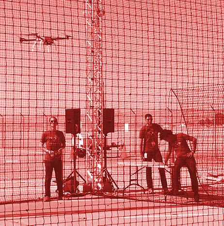
From Unmanned Systems magazine: UAS helping wireless industry fly toward 5G
Not so long ago, it was groundbreaking for wireless companies to use drones at all. Among the first news-making developments for unmanned aircraft in the industry were deployments to inspect cell phone towers.
But recent research projects highlight far more fundamental ways that wireless leaders are using UAS — to help plan the standards and configurations for next-generation networks, and maybe even to provide telecommunications infrastructure that can fly in where ground-based networks are unavailable.
A few examples:

Volaero Drones using UAS and thermal technology to track pythons in the Florida Everglades
Volaero Drones, which is a professional UAS services company based in Miami, Florida, has teamed up with Bill Booth Outdoors and Bruni Infrared to track pythons in the Florida Everglades, using UAS and thermal technology.
More than 100,000 Burmese pythons are estimated to be living in the Everglades, and they are reportedly “ravaging the wildlife.”
The state’s small mammal population is being decimated as a result of the python population multiplying exponentially, thanks in large part to the fact that female python can lay up to 80 eggs per clutch.
Farmers Insurance launches UAS program
In an effort to “enhance the claims experience for customers who have suffered significant damage to their roof following major weather events,” Farmers Insurance has announced that it is launching a UAS program.
Farmers conducted field tests to examine the “most effective and customer-centric ways” of utilizing UAS technology with its existing claims operation. Now, the company will expand its use of the technology to help with residential property damage assessments, as it seeks to provide a more enhanced experience for its customers.
