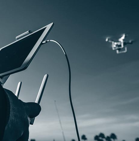
The Property Drone Consortium (PDC), which is a collaboration made up of insurance carriers, roofing industry leaders and supporting enterprises, has been granted an FAA waiver that allows it to fly small UAS at night.
The waiver requires adherence to several provisions, including using a visual observer, flying with anti-collision lighting on the platform, and flying in Class G airspace, as well as compliance with all other Part 107 provisions.
Technology
Technology
Moore County Sheriff's Office locates missing child using UAS
North Carolina’s Moore County Sheriff’s Office recently used a UAS to locate a missing 11-year-old child.
After arriving to the Jackson Springs, North Carolina residence where Moore County Sheriff’s deputies were dispatched on the night of March 1, Moore County Sheriff’s Office Drone Pilot, Lieutenant Tim Davis immediately launched the department's DJI Matrice 210 UAS to search for the child. Within just 15 minutes, the UAS observed a heat signature in the wooded area approximately 100 yards from the residence across the highway.
Lieutenant Davis used his radio to direct deputies to the location of the heat signature, and the deputies located the child, sleeping under some thick tree limbs and brush.

Minnesota firefighters learn how UAS can assist their operations
During the finale of the 2018 Minnesota State Fire School & Expo, a few dozen area firefighters learned about UAS and how the technology can be used in emergency situations.
As a part of their class, firefighters received a lecture about UAS, which was followed by a live demonstration of the technology in action. During that demonstration, firefighters got to see the different maneuvers and functions of the UAS in the sky, and they could also view what the camera was capturing on a TV.
The class, which was taught by Al Ebbinga, was meant to not only show how UAS can benefit first responders on scene, but it was also meant to “clarify the perception of the name "drone" and how it's been used.”
Weekend Roundup
This Week in the Unmanned Systems and Robotics World
Milrem Robotics introduced its next generation THeMIS UGV during UMEX 2018 in Abu Dhabi. Equipped with autonomous capabilities, the UGV is “intended specifically” for desert terrain and hot climates. (Business Wire)
")
Northeast Region UAS Unit begins proactive deployment of its UAS
According to a news release from the Grand Forks County Sheriff's Department in Grand Forks, North Dakota, via the Grand Forks Herald, the Northeast Region Unmanned Aircraft Systems Unit will begin proactive deployment of its UAS on March 1, which will allow officers that are trained as pilots to take UAS with them as they patrol their areas.
The unit has authorization to fly UAS anywhere in the nation, according to Sheriff's Lt. B.J. Maxson, who oversees the Northeast Region UAS Unit.
Before this week’s development, the unit had just two UAS, and required law enforcement to go to the Sheriff's Department to pick up the UAS. This meant that the unit was used as a reactionary measure.
Northrop Grumman's Global Hawk UAS celebrates 20th anniversary of first flight
Northrop Grumman is celebrating the 20th anniversary of the first flight of its autonomous Global Hawk high altitude long endurance aircraft, which occurred at Edwards Air Force Base in California on Feb. 28, 1998.
The flight occurred after a pilot in a nearby ground control station clicked the take-off button on their control console, sending the Global Hawk into the desert sky. The UAS completed a 56-minute flight before landing safely and stopping itself on the runway, just six inches off the painted centerline.
The first Global Hawk aircraft, named Air Vehicle 1, or AV-1, was built by Teledyne Ryan Aeronautical—which Northrop Grumman would go on to acquire in 1999— at the Ryan factory near San Diego’s Lindbergh Field.

ECA Group unveils AUV A18-M for underwater mine warfare
France’s ECA Group has unveiled its new generation mid-size AUV A18-M for underwater mine warfare.
Built for “efficient mine detection and classification in all water depths up to 300m,” AUV A18-M is specifically designed to operate in the close vicinity of the smartest mines without triggering them, according to ECA Group.
Regarding AUV A18-M, ECA Group says that “with its compactness and its unequaled high-quality imagery this new generation underwater drone becomes the reference in the category of autonomous underwater vehicles dedicated to mine hunting.”

University at Buffalo researching, and planning to test, recently acquired driverless bus
The University at Buffalo (UB) recently purchased a driverless Olli bus that it plans on testing once the bus is delivered to the university, which is expected to happen towards the end of April.
A product of Local Motors that has been tested in several countries throughout Europe, the Olli bus will be operated by researchers at UB on private or sanctioned-off roads on UB’s campus.
New York State law requires that the bus be operated on North Campus’ Service Road, which is not public. If UB researchers want to test the bus on public roads, they must apply to test through the DMV, pay $5,000,000 in liability fees and arrange for a police escort. New York has allowed UB to test its newly-purchased vehicle on campus roads.

UAVOS introduces new VTOL UAV
During the UMEX conference in Abu Dhabi, UAVOS Inc. is introducing “«SURVEYOR-H» Unmanned Aerial System with «UVH-290E» drone vertical takeoff/landing.”
In the “tractor” modification, the new unmanned helicopter has a takeoff weight of 192 pounds. UAVOS says that the UAV is designed so that parameters such as durability, extended operation life, ease of use and serviceability have a priority over flight time and load capacity of UAVs.

Terabee's new TeraRanger Hub Evo provides 'lean sensing' for robotics
Terabee, which created the TeraRanger Time of Flight distance sensors, has announced the release of the TeraRanger Hub Evo, which the company describes as a new generation “plug and play solution for using multiple distance sensors.”
A “small, octagonal, PCB,” the TeraRanger Hub Evo allows users to connect up to eight TeraRanger Evo distance sensors and place them in whatever configuration they might need, so that they can monitor and gather data from just the areas and axes they need, and create custom point clouds, optimized to their application.
